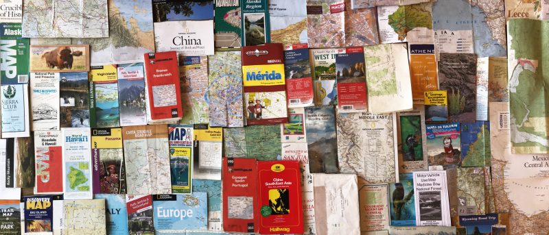
I have been saving my maps since my first international trip in 1975. When I see them now, they bring back memories of the routes I took and the adventures I had along the way. I sometimes made notes on my maps – of the roads I traveled, the towns I visited and the dates I was there. I didn’t think of maps as sacrosanct. They were user-friendly, there for adding details.

In these maps, I see my grape-harvesting job in France, a 3-week bicycle trip in the San Juan Islands with one of my sisters, road trips across Mexico, Panama and Italy with my family, work trips to the Middle East, hiking in Hawaii, Alaska and around my home in the Rocky Mountains.
One of my favorite maps is a topo map of northern China. I went there in the early-90’s to do a “first descent” of a river in a remote area. It was so long ago, that without that map, I might not remember all of the towns we stopped in- and the lake in which I nearly swam (unknowingly) to North Korea. But with that map, the details are clear. I still use maps wherever I go – even if I have GPS – I take my map. This photo makes me realize that these maps are such a big part of me – and they make a very strong self-portrait.


Comments are closed